
 LinkBack URL
 About LinkBacks
English | File size: 5.12 MB
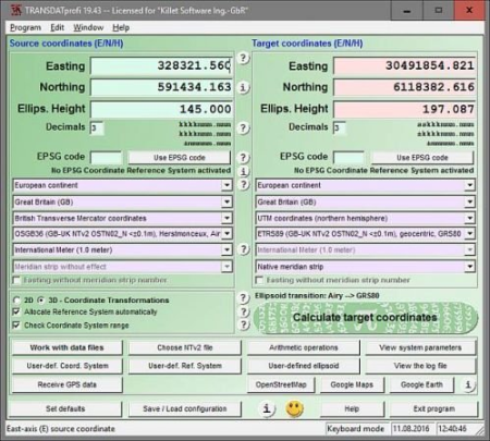
TRANSDATpro performs Coordinate Transformations fast and with high accuracy.
The geodetic program supports worldwide thousands of Coordinate Systems, geodetic Reference Systems and Datum Shifts, user-defined systems, 2D/3D transformations, INSPIRE, NTv2, HARN, EPSG, GPS, continental drift and more. The coordinate converter reads and writes the file formats Text, CSV, SDF, dBase, Arc-Shape, Arc-Generate, KML, GPX and others. Furthermore: Outdoor GPS reception, mapping in Google Earth, Google Maps and OpenStreetMap, Meridian Convergence and Extra Parameter, Polygonal scopes in NTv2 files, multilingual user interface.YTD comes bundled with a reliable media player, suitable for watching the ed videos or music. Moreover, you may preview the files in the queue, as they are being ed or converted. The software is reliable and highly capable when it comes to preserving the video or audio quality. It can also multiple videos at once without slowing down your computer.
Data input, data output and file formats:
Keyboard Mode for direct input of coordinates;
File Mode for data input from files and data output to files;
Batch Mode for batch processing of multiple files using a control file;
File formats Text, CSV, SDF, dBase, ArcShape and ArcGenerate for data input;
File formats Text, CSV, SDF, dBase, KLM, ArcShape and ArcGenerate for data output;
Conversion from one file format to another;
Very flexible file configuration;
Various filters for the input file;
Control of the notation of coordinates;
Copy function for Text, CSV, and dBase files;
Finding scattered coordinates in Text files;
Processing of text files without line orientation;
Shape to Shape function;
Shape to KLM function;
Support of the ArcGenerate GIS exchange format for geometries;
Log file with the results of the current session;
Export and import to / from configuration files;
One-click copy and paste of all coordinate components simultaneously.
Strict formulas of Schatz, Schuhr, Klotz and Hooijberg;
Transformation parameters of the Surveying Authorities of the respective countries;
Consideration of the EPSG specifications;
Helmert 7-parameter Bursa-Wolf and Molodenski reference system transitions;
Exact NTv2 transformations for many countries;
High-precision NTv2 transformations for the German Federal States and other states provinces;
Source and target Coordinate Reference Systems;
World-wide and country-specific Coordinate Reference Systems;
Current and historical Coordinate Reference Systems;
Numeric and alphanumeric Coordinate Systems;
UTMRef, GEOREF, QTH, BNG and ING with different grid mesh sizes;
INSPIRE systems, ITRS annual realizations, WGS84 epochs, GPS coordinates;
D and 3D Coordinate Transformations;
Automatic selection of the quired NTv2 files;
Use of EPSG codes of the Coordinate Reference Systems;
Hierarchical structure by continent, country, Coordinate System, Reference System, Measurement Unit;
Selection of the meridian strip with UTM and Gauss-Krueger coordinates;
UTM and Gauss-Krueger coordinates with and without meridian strip number;
Selection of measurement units;
Use of summands and multipliers for the coordinate components;
Monitoring of range limits;
Option for automatic assignment of a Reference System to the Coordinate System;
Option for automatic assignment of a NTv2 files to the Reference System;
Viewer for the input and output files;
Display of shapefiles in a Shape Viewer;
Display of KML files in Google Earth;
Display of the last calculated coordinates in Google Maps / Earth and OpenStreetMap;
Screenshots of all program windows in BMP and GIF files;
Print of all program window with the corresponding settings;
View of the NTv2 parameters in a NTv2 Viewer;
View of the actual Coordinate Transformation parameters in a System Viewer;
Adjustable color design with color gradients;
Reception of GPS coordinates with external GPS device;
GPS device or GPS-mouse by serial or USB interface;
Direct transformation of GPS coordinates;
Triggered and manual GPS reception;
Generating of a GSP file;
Display of the received GPS coordinates in a GPS Viewer;
Detailed electronic manual;
Case-related assistance in all program windows;
Focused Info buttons for workspaces which need to be explained;
Uniformly geodetic terms on the program interface and in the electronic manual;
Explanation of geodetic terms in the glossary;
Online FAQ section for common questions;
Helpful online information;
Language choice for the user interface;
User interface in seven different languages;
Option to include new languages by the users;
User manual in English and German;
Possibility to NTv2 files from the KilletSoft website;
Configuration of user defined coordinate systems;
Configuration of user defined reference systems and ellipsoids;
Network capability;
CITRIX support;
Possibility of a service contract for phone and email support;
Possibility to use the automated newsletter service via email;
Transfer of transformation parameter sets from the SEVENPAR program;
Display of electronically generated fractals for relaxation.
Updates: official site does not provide any info about changes in this version.
DOWNLOAD
uploadgig
rapidgatorKod:https://uploadgig.com/file/download/85F6D5543fB9A991/t9BSlzIo_.Killet_TRA.rar
nitroflareKod:https://rapidgator.net/file/8027881f5b8f4f54e149b37024188319/t9BSlzIo_.Killet_TRA.rar
Kod:http://nitroflare.com/view/B11E7DFE671D030/t9BSlzIo_.Killet_TRA.rar

1 sonuçtan 1 ile 1 arası
Hybrid View
-
11.03.2020 #1Üye


")
- Üyelik tarihi
- 17.12.2018
- Mesajlar
- 28.592
- Konular
- 0
- Bölümü
- Gıda
- Cinsiyet
- Erkek
- Tecrübe Puanı
- 35
Killet TRANSDAT Pro 23.13 Multilingual


 Alıntı
Konu Bilgileri
Users Browsing this Thread
Şu an 1 kullanıcı var. (0 üye ve 1 konuk)

Konuyu Favori Sayfanıza Ekleyin