
 LinkBack URL
 About LinkBacks
Multilingual | File size: 5.12 MB
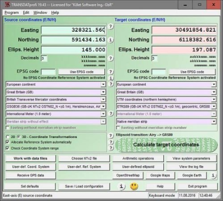
TRANSDATpro performs Coordinate Transformations fast and with high accuracy.
The geodetic program supports worldwide thousands of Coordinate Systems, geodetic Reference Systems and Datum Shifts, user-defined systems, 2D/3D transformations, INSPIRE, NTv2, HARN, EPSG, GPS, continental drift and more. The coordinate converter reads and writes the file formats Text, CSV, SDF, dBase, Arc-Shape, Arc-Generate, KML, GPX and others. Furthermore: Outdoor GPS reception, mapping in Google Earth, Google Maps and OpenStreetMap, Meridian Convergence and Extra Parameter, Polygonal scopes in NTv2 files, multilingual user interface.Data input, data output and file formats:
Keyboard Mode for direct input of coordinates;
File Mode for data input from files and data output to files;
Batch Mode for batch processing of multiple files using a control file;
File formats Text, CSV, SDF, dBase, ArcShape and ArcGenerate for data input;
File formats Text, CSV, SDF, dBase, KLM, ArcShape and ArcGenerate for data output;
Conversion from one file format to another;
Very flexible file configuration;
Various filters for the input file;
Control of the notation of coordinates;
Copy function for Text, CSV, and dBase files;
Finding scattered coordinates in Text files;
Processing of text files without line orientation;
Shape to Shape function;
Shape to KLM function;
Support of the ArcGenerate GIS exchange format for geometries;
Log file with the results of the current session;
Export and import to / from configuration files;
One-click copy and paste of all coordinate components simultaneously.
Quality:
Strict formulas of Schatz, Schuhr, Klotz and Hooijberg;
Transformation parameters of the Surveying Authorities of the respective countries;
Consideration of the EPSG specifications;
Helmert 7-parameter Bursa-Wolf and Molodenski reference system transitions;
Exact NTv2 transformations for many countries;
High-precision NTv2 transformations for the German Federal States and other states provinces;
Source and target Coordinate Reference Systems;
World-wide and country-specific Coordinate Reference Systems;
Current and historical Coordinate Reference Systems;
Numeric and alphanumeric Coordinate Systems;
UTMRef, GEOREF, QTH, BNG and ING with different grid mesh sizes;
INSPIRE systems, ITRS annual realizations, WGS84 epochs, GPS coordinates;
D and 3D Coordinate Transformations;
Automatic selection of the quired NTv2 files;
Use of EPSG codes of the Coordinate Reference Systems;
Hierarchical structure by continent, country, Coordinate System, Reference System, Measurement Unit;
Selection of the meridian strip with UTM and Gauss-Krueger coordinates;
UTM and Gauss-Krueger coordinates with and without meridian strip number;
Selection of measurement units;
Use of summands and multipliers for the coordinate components;
Monitoring of range limits;
Option for automatic assignment of a Reference System to the Coordinate System;
Option for automatic assignment of a NTv2 files to the Reference System;
Visualization:
Viewer for the input and output files;
Display of shapefiles in a Shape Viewer;
Display of KML files in Google Earth;
Display of the last calculated coordinates in Google Maps / Earth and OpenStreetMap;
Screenshots of all program windows in BMP and GIF files;
Print of all program window with the corresponding settings;
View of the NTv2 parameters in a NTv2 Viewer;
View of the actual Coordinate Transformation parameters in a System Viewer;
Adjustable color design with color gradients;
GPS reception:
Reception of GPS coordinates with external GPS device;
GPS device or GPS-mouse by serial or USB interface;
Direct transformation of GPS coordinates;
Triggered and manual GPS reception;
Generating of a GSP file;
Display of the received GPS coordinates in a GPS Viewer;
Help System:
Detailed electronic manual;
Case-related assistance in all program windows;
Focused Info buttons for workspaces which need to be explained;
Uniformly geodetic terms on the program interface and in the electronic manual;
Explanation of geodetic terms in the glossary;
Online FAQ section for common questions;
Helpful online information;
Multilingualism:
Language choice for the user interface;
User interface in seven different languages;
Option to include new languages by the users;
User manual in English and German;
More features:
Possibility to NTv2 files from the KilletSoft website;
Configuration of user defined coordinate systems;
Configuration of user defined reference systems and ellipsoids;
Network capability;
CITRIX support;
Possibility of a service contract for phone and email support;
Possibility to use the automated newsletter service via email;
Transfer of transformation parameter sets from the SEVENPAR program;
Display of electronically generated fractals for relaxation.
DOWNLOAD
uploadgig
rapidgatorKod:https://uploadgig.com/file/download/2A6686e7bd375afe/ULnORmk7_.Killet_TRA.rar
nitroflareKod:https://rapidgator.net/file/ae348a191633559ffa57ad7492595146/ULnORmk7_.Killet_TRA.rar
Kod:http://nitroflare.com/view/84268EA189008CA/ULnORmk7_.Killet_TRA.rar

1 sonuçtan 1 ile 1 arası
Threaded View
-
15.02.2020 #1Üye


")
- Üyelik tarihi
- 17.12.2018
- Mesajlar
- 28.592
- Konular
- 0
- Bölümü
- Gıda
- Cinsiyet
- Erkek
- Tecrübe Puanı
- 35
Killet TRANSDAT Pro 23.11 Multilingual


 Alıntı
Konu Bilgileri
Users Browsing this Thread
Şu an 1 kullanıcı var. (0 üye ve 1 konuk)

Konuyu Favori Sayfanıza Ekleyin